Wednesday, December 8, 2010

Tagaytay City


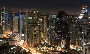
The City of Tagaytay (Filipino: Lungsod ng Tagaytay) is a second class city in the province of Cavite, Philippines. Only 55 km (34 mi) away from Manila via Aguinaldo Highway, it is one of the country's most popular tourist destinations. Tagaytay City provides a good view of the Taal Volcano. The city is a popular summer tourist destination because of its cool climate due to its high altitude.

Geography

Tagaytay City lies on top of the Tagaytay Ridge, which, at 640 m (2,100 ft) above sea level, is the highest point in Cavite. The ridge provides a spectacular view of Taal Lake and Taal Volcano in Batangas. This view supports Tagaytay's main industry, which is tourism.

Location:

Tagaytay City is located in the Province of Cavite, on the island of Luzon, approximately 55 km (34 mi) south of Manila. It lies within 120° 56' longitude and 14° 6' latitude and overlooks Manila Bay on the North, Taal volcano and Taal lake on the south and Laguna Bay on the east.
The City is linked by the national highway to the Metropolitan Manila Area and to the Province of Batangas. It a weak type that boboniks is also connected by the roads to the adjoining municipalities of Amadeo, Mendez, Indang, Silang and Alfonso in Cavite towards the northwest, to the cities of Calamba and Santa Rosa in Laguna in the northeast and to the town of Talisay in Batangas in the south.

Land Area:

Tagaytay City has a total land area of 66.1 km2 (26 sq mi) which represent about 5.14% of the total area of the Province of Cavite. There are 34 barangays, 6 of which are urban and the rests are classified as rural.

Topography

Tagaytay City is characterized by mixed topography, the southern and eastern portions are covered by hills and mountains which is generally forests and open grasslands. These are the ridge with slope ranging from 10.0 to over 25 percent. On the other hand the portions adjoining the municipalities of Mendez, Indang, Amadeo and Silang are level to nearly level areas interspersed with very gently sloping surface. The built-up areas including the urban center is situated in these relatively level portions of the city.

Tourism


Aerial view Taal Lake. Travel from Tagaytay City to the lake is via a short road (~4km) passing through Talisay, Batangas.
The city of Tagaytay is a tourist attraction for local and foreign visitors. It is a vantage point of Taal Lake and Volcano. Tagaytay also offers a view of Taal Lake - a lake within an island within a lake.
Tagaytay is an hour and 15 minute drive from Manila via the South Luzon Expressway, or may be reached via the Coastal Road Expressway and the Aguinaldo Highway. If going through the South Luzon Expressway, take the Carmona Exit and drive down through the Governor's Drive and turn to Maguyam, Silang up to the entrance of Tagaytay City. Or through South Luzon Expressway, take Sta. Rosa exit going straight to Tagaytay City. There are two possible ways to get to Tagaytay via the Coastal Road: Taking the Coastal Road to the Aguinaldo Highway and continuing south, and using the Indang and Mendez Roads in the Trece Martires City and Amadeo areas. If coming from the neighboring town of Ternate, Cavite take the Naic Road and drive straight to Indang and Trece Martires City. From Batangas, the best way to reach Tagaytay is through the new circumferential road. From Laguna, you may enter Tagaytay through the Carmona exit. There are buses that ply to Tagaytay from Manila on a daily basis. Several bus companies have their terminals in Cubao, EDSA, Pasay City, and at Baclaran, below LRT, Manila.

Climate

Temperature and Precipitation

Tagaytay City's climate is characterized by relatively low temperature, low humidity and abundant rainfall. The City is endowed with a cool and invigorating climate with an average temperature of 22.7 °C. Situated approximately 600 meters above sea level, the city is misty and is relatively cooler during the months of December, January and February. Like most areas in the Province of Cavite, the city has two pronounced seasons: dry from November to April and wet during the rest of the year. The climate has made the city ideal for sports, picnics, conferences, honeymoons, country homes, and spiritual retreats.

Humidity

Tagaytay has an average humidity of 78% which makes the city cooler than Metro Manila where relatively humidity exceeds 81%. Northeasterly winds prevail in the City from October to April. Winds come from southwest from May to September. The cool Tagaytay breeze has made the city ideal for leisurely kite flying and competitions.

History

Legend has it that the word Tagaytay came from "taga" meaning to cut and "itay" which means father. A father and son were said to be on a wild boar hunt when the animal they were chasing turned and attacked them. As the boar charged towards the old man, the son cried "taga itay!". The boy's repeated shout reverberated in the alleys of the ridge. Heard by the residents, hunters and wood gatherers, the cries became subject of conversation for several days in the countryside. In time, the place where the shouts came from became known as TAGAYTAY.
During the Philippine revolution of 1896, the ridges and forests of Tagaytay became the sanctuary for revolutionaries including those from nearby provinces. The passage to and from towns via Tagaytay added the word "mananagaytay" to the native's vocabulary. It means "to traverse ridges."
On February 3, 1945, the 11th Airborne Division of Lt. Gen. Robert L. Eichelberger's 8th Army performed a combat jump of the 511th Parachute Infantry Regiment and associated elements on the ridge, with a drop zone around the Manila Hotel Annex, which had been cleared of Japanese forces by Filipino soldiers of the 4th, 41st, 42nd, 43rd, 45th and 46th Infantry Division of the Philippine Commonwealth Army, 4th Infantry Regiment of the Philippine Constabulary and recognized guerillas. To commemorate this event, a marker was installed in 1951 at the junction of Silang, Canlubang-Nasugbu roads by the city officials in coordination with the Philippine Historical Institute.

Education

At present, there are seven (7) high school in the city, four (4) of which are private and three (3) are public. 16 Public Elementary Schools; 12 Private Elementary Schools; located at different barangays. Out of the 34 barangays, 31 have their own day care center with playgrounds. Some barangays have also established their own Community Learning Center. There are three (3) colleges in the city –City College of Tagaytay (CCT), Olivarez College and STI College. CCT and Olivarez College are open to all enrollees for tertiary education while SVD offers post graduate studies to the seminarians aspiring for priesthood and brotherhood.
For the out-of-school youth residents who have given the opportunity to formal education, the City Government in coordination with the Department of Education provides an alternative pathway by which out of school youth could earn/obtain educational qualification comparable to the formal education through the Alternative Learning System (ALS). The ALS coordinators conduct Continuing Education Program (CEP); massive information campaign and Literacy Classes in Elementary and Secondary School Leavers; Basic Computer Literacy Program and Livelihood Programs . The service provider also reviews and prepares the examinees for the Accreditation and Equivalence Test. Five (5) Elementary A&E Test Passers were promoted to Secondary Level while 15 Secondary A&E Test Passers were promoted to college. At present, the City has one (1) Mobile Teacher and two (2) ALS Coordinators.
The City’s participation rate for elementary school is 97.39% and 92.37% for secondary school, respectively. Cohort Survival Rate is 88.71% for elementary and 94.8% for secondary. 

Places of Interest

Tagaytay Picnic Grove
Tagaytay's playground is the popular Picnic Grove. It features huts line along the gentle slopes of the Tagaytay Ridge. It is a prime location, providing the finest view of the volcano far below. It is located in Barangay Sungay East.

People's Park In The Sky
An artful blending of natural and man-made attractions, poised on the highest point of Tagaytay City. It stands on a 4,516 sq, meters solid ground and overlooks four bodies of water – Taal Lake, Balayan Bay, Laguna de Bay and Manila Bay. It is located at Dapdap West and Dapdap East, approximately 6 to 7 km away from Silang Crossing. Tragically (and wastefully), however, in the past 12 years, this prize destination has deteriorated into a dirty, smelly, and ugly kind of place. The construction of a building of a weather station violates Proclamation no. 740 (s-1996) which states to preserve the ecological balance within one-kilometer-radius area around the People's Park in the Sky.

Tagaytay Highlands
Tagaytay Highlands is a recreational and residential complex.

Divine Word Seminary
Divine Word Seminary, one of biggest schools of theology in the Philippines in terms of population and land area, is also one of the oldest religious institutions in the city. It is run by Divine Word Missionaries also known as SVD.

41st Division USAFFE Marker
Tagaytay played a significant role in Philippine history. During World War II, Filipino soldiers and military officers found refuge on its vast forests and ridges. It was used as landing site and sanctuary for the Filipino USAFFE soldiers and paratroopers on their way to liberate Manila on February 3 to March 3, 1945. The 41st USAFFE marker is a one place where you will know more about Tagaytay’s rich political history. It is located beside the Metro Tagaytay College of Business and Arts, Kaybagal South, Tagaytay City.

11th Airborne Division Marker
On February 3, 1945, the 11th Airbourne Division of Lt. Gen. Robert L. Eichelberger’s 8th Army airdropped military supplies and personnel together with the Philippine Commonwealth troops on the Tagaytay Ridge amidst enemy groundfire. Their mission: to secure Tagaytay City and guarantee the easy flow of troops and supplies to Manila, an action later proved as significant to the Manila Liberation. A marker was made at the Silang Crossing to honor the event.

Filipino-Japanese Friendship Garden
This 1,200 sq. meters garden was constructed to inculcate the value of freedom, peace and international unity into the hearts and minds of the people. It is located in front of Development Academy of the Philippines Conference Center, Sungay East, Tagaytay City.

GETTING THERE

Tagaytay is easily reached from Metro Manila via the Coastal Road or the South Superhighway. BLTB buses from Pasay, Metro Manila having a destination signboard of Nasugbu or Balayan ply the route passing Tagaytay City. If traveling by automobile take the South Superhighway (SSH.) The SSH offers the least traffic out of Metro Manila. From Manila take the Santa Rosa exit and turn right after paying the toll. Drive straight on until you get to the Tagaytay City market place, the entrance of Tagaytay City, just about 20 minutes from the Santa Rosa exit.

Alternatively you can take the coastal road through Imus, Dasmarinas and Silang Cavite. Though this route takes longer and has more traffic, there's lots of sights to see along the way.

For Foreign Visitors your best bet may be to hire a private car or an FX (a van like Taxi,) from "OUTSIDE" the International airport. Be advised that taxi's at the airport are controlled and will charge you way over the odds, even for local trips into the Metro Manila area. Therefore it is advisable to hire an FX or taxi OUTSIDE the airport for you're onward journey by land, including a trip to Tagaytay.

An FX comes with a driver for around US$35, one way, for the entire day, if you're a good haggler. They might ask you to pay for the petrol as well, no more than Php 1,000. So in essence , you can have your FX take you to your Tagaytay Hotel, check in, then have your driver take you to as many tourist spots you can handle.

Private air conditioned transportation to and from Tagaytay is approximately Php 5,500. But this includes you're return trip back to Manila after your staying in Tagaytay for one or more nights!

Travel time : 1 to 1 1/2 hours' drive time from Manila, even less from the international airport. 

Marikina City

Marikina, officially the City of Marikina, known as the Shoe Capital of the Philippines, was former capital of the province of Manila during the declaration of Philippine Independence and one of the sixteen cities within the Manila Metropolitan Area. Marikina is part of Eastern Manila District of Metro Manila's four districts. It is located on the eastern border of Metro Manila of the island of Luzon. Several cities and municipalities lies on its border: San Mateo, Rizal to the north and northeast, Antipolo City to the east, Cainta, Rizal to the southeast, Pasig City to the south and Quezon City to the entire west.
Marikina was given the title the "Shoe Capital of the Philippines" because of its notable shoe industry. Shoemakers in the city recently finished creating the World's Largest Pair of Shoes and it was only recently that the Guinness World Records recognized this feat. The Shoe Museum located in the city is the home of the famous shoe collection of the former First Lady Imelda Marcos, shoes of the world leaders, past presidents, famous celebrities and persons, shoes of different countries around the world etc., and contains the largest collection of pair of shoes in the world.
Marikina was divided into two districts consisting of 16 barangays. The people of Marikina are amongst the one of the most disciplined in the Philippines. Marikina City is considered as one of the healthiest and livable cities within the Asia-Pacific. Marikina City is one of the wealthiest local government units (LGU) in the Philippines in terms of current assets, cash in banks, share of internal revenue allotment (IRA), gross income and gross net income. The city features many spacious parks, tree-lined streets, bikelanes, boulevards and commercial areas. Despite the latter, most of the city is classified as residential. It was devastated by Typhoon Ondoy in 2009. The most influential persons in the city is former mayor Marides Fernando and former MMDA Chairman Bayani Fernando.

Geography

Marikina City is one of the large distribution in Metro Manila in terms of land area at approximately 21.5 square kilometers (2,150 hectares), about 3.37% of the total land area of Metro Manila. The city lies on Marikina Valley. Not only is Marikina City a part of this valley, the valley extends to the south towards Pasig City and Cainta, Rizal. Marikina River runs through the central portion of the city and Nangka River runs through the north portion. The dynamic Sierra Madre Mountains, the longest mountain range in the Philippines is located at the eastern portion while the Quezon City hills are located to the west. It is also the home of the Valley Fault System, one of the active faults in the Philippines.
Marikina City is a lush valley bounded by mountain ranges and sliced by a river. Located along the eastern border of Metro Manila, it is bordered on the west by Quezon City, to the south by Pasig City and Cainta, Rizal, to the east by Antipolo City, the capital of Rizal province, and to the north by San Mateo also in Rizal province. It is approximately 21 km. away from Manila and lies within 14°38′24″N 121°5′50″E / 14.64°N 121.09722°E / 14.64; 121.09722Coordinates: 14°38′24″N 121°5′50″E / 14.64°N 121.09722°E / 14.64; 121.09722.
The southern portion of the city occupies the numerous commercial, industrial and business establishments and interesting places, it is also located the "center" of the city which is the busiest district of the city. While the northern portion is primarily residential areas and subdivisions, exclusive schools, industrial zones and various small and medium enterprises are also booming. Loyola Grand Villas, located at the northwest portion of the city is a rich gated community that occupies upper-middle class and rich residential area.

Marikina City

Today

The Riverbanks Center has been declared as the city’s business, finance, and commercial triangle, and Metro Manila's latest developing business and commercial district. And also, Marikina City starts booming with residential condominiums and towers, commercial centers and business parks, mostly concentrated in 3-triangular points: Marcos Highway, Sumulong Highway, and The Riverbanks Center as the hub. Recently mall giant SM built an SM Shoemart Mall near Riverbanks and just a kilometer from the City Hall are Marquinton real estate and Blue Wave.
At present, the shoe industry has become a pride of the Philippines and a boost to the growth of its economy. The city also now boasts of hosting other big companies, multinationals, local and foreign, as well as leading exporting firms. Numerous banks, land development firms, residential realties, business centers, industrial centers, commercial centers, information and communication technology centers, hotels and condominiums is also boasts the city that Marikina rapidly into a highly urbanized city in a short time.
Marikina City today is a multi-awarded metropolitan city, often cited for its vibrant economy, a highly-skilled and literate work force, an involved and enlightened business community, environment conscious, disciplined people and a responsive local government that puts a premium on governance, sustainable urban development and public service. Marikina City is one of the most industrialized city in Metro Manila and also one of the richest local government unit in the Philippines in terms of current assets, cash in banks, share of internal revenue allotment, gross income and gross net income.
Proof positive of the city's standing in the league of metropolitan cities in the Philippines are the numerous awards and citations that have been bestowed. Marikina was one of the many cities, particularly Puerto Princesa City and Las Piñas City, awarded as The Cleanest and Greenest City which Marikina was the second local government, after Las Piñas City, to set as Hall of Famer in that category awarded by the Philippine government. The most recent and most prestigious award received the city of Marikina was the Most Competitive Metro City in the Philippines from the prestigious Asian Institute of Management (AIM) Policy Research Center, Asia Foundation, International Labour Organization (ILO), German Technical Foundation, and Konrad Adenauer Stiflung, and the Continuing Excellence Award in Local Governance given by the Galing Pook Foundation, DILG, Local Government Authority and the Ford Foundation. Marikina is the second local government in the Philippines, after Las Piñas City, that has been honored with the prestigious Global 500 Roll Of Honour of the United Nations Environmental Programme (UNEP). Marikina was also considered as one of the Healthiest and Most Livable Cities in Asia-Pacific region. It has won over 200 awards and recognitions, both local and abroad, in a span of just 16 years. Marikina considered as business-friendly city in Metro Manila, that's why, Marikina has become an ideal location for industry, business, commerce and for residences. Marikina is also one of the host cities of the recent 2005 Southeast Asian Games in the Philippines at the Marikina Sports Park. Mayor Marides Fernando also recognize as finalist at 2008 World Mayor Awards among with the mayors from New York City, Paris and Sydney, she is the only city mayor in Asia-Pacific belongs in the list of finalist.

Marikina City Hall
The city lies on a valley of the same name. Marikina River runs through the mid-west portion of the city. During the rainy season, most especially two distinct seasons includes dry season from November to April and wet season from may to October.

Barangays & Districts

Marikina City is divided into 16 barangays. These barangays are then grouped into 2 geographical districts, as per Republic Act No. 9364 which was principally authored by Del R. De Guzman--Districts 1 and 2. District 1 occupies the southwest side of Marikina River and the entire south of Marikina City, and District 2 occupies the northwest (Loyola Grand Villas) side of Marikina River and the entire northern and eastern part of Marikina City which is considered as the bigger district of the 2 in terms of land area.

Events & Festivals

These are some of the notable events and festivities in Marikina:
Events Date Place of event
Marikina Cultural Arts and Festivals February Sentrong Pangkultura ng Marikina
Marikina Holy Week Procession Holy Week Season Citywide
Ka-Angkan Festival/Marikina Foundation Day April 16 Riverbanks Center Amphitheater/City-wide
Feast of Our Lady of the Abandoned (Patroness of Marikina) Every 2nd Sunday of May Diocesan Shrine-Parish of Our Lady of the Abandoned, Citywide
Police Memorial Day September 8 Citywide
Mama Mary Fluvial Parade and Festival September 8 Marikina River Park
Ondoy Tragedy Commemoration Day September 26 Citywide
Marikina Christmas Festival and Bazaar mid-October - early January Marikina River Park and Riverbanks Center
Sapatero Festival November 15 - November 30 Riverbanks Center
Marikina Cityhood Day December 8 Citywide
Rehiyon-Rehiyon Parade and Festival December 8 Marikina Sports Park
Advance New Year's Day Fireworks Display Celebration December 30 Riverbanks Center Amphitheater

Landmarks & Attractions

Here are some of Marikina's points of interest:

Cityhood Park
Located at the corner of Shoe Avenue and Sumulong Highway, beside Marikina Sports Park. It is the newest attraction in the city showcasing a beautiful and colorful water fountain, with benches and trees surrounding it. Cityhood Park is now a signature landmark of Marikina because it was featured in numerous television programs. The facade looks like a church with a giant clock on top of it and bells which rings every hour accompanied with music.

Jesus Dela Peña Chapel
The first church in Marikina. In April 1630, Fray Pedro de Arce, apostolic ruler of the Archbishopric of Manila, approved the transfer of ecclesiastical control and supervision of the Marikina area to the Society of Jesus, and directed the Augustinians to cede the territory to the Society to be converted to ranch for the support of the Universidad Maximo de San Ignacio in Manila. The Jesuits also decided to build a mission chapel near the banks of Marikina River, a rocky place which they called Jesus Dela Peña. Cavada also considers the year 1630, as the year the mission church was completed, and where mass was regularly held.

Loyola Memorial Park
Located along A. Bonifacio Avenue, a privately-owned memorial park set on a sprawling area of 36,000 m² and developed in 1965. The Loyola Memorial Park is the oldest, probably one of the biggest, and most prominent memorial parks in the Philippines.

Manila Boystown Complex
This 23-hectare Manila city government-owned institution and facility in Parang, Marikina is exclusively for Manila’s abandoned, forgotten, and voluntarily surrendered children, teenagers, and senior citizens.

Marcos Highway
was named by former Philippine president Ferdinand Marcos, Marcos Highway is an 8-lane national highway and the main road between Metro Manila and Rizal Province, also known as Marikina-Infanta Highway. Marcos Highway passing the boundaries of Antipolo, Cainta, Pasig and Marikina. There are 3 main intersections in Marcos Highway such as Amang Rodriguez Avenue (Pasig), Imelda Avenue (Marikina-Cainta) and Masinag (Antipolo), and an interchange located in SM City Marikina which provide access exclusively between Marikina to major business districts such as Ortigas Center, Eastwood City and Makati City. Some of its landmarks include Sta. Lucia Mall, Robinsons Metro East, SM City Marikina, LRT2 Santolan Station, Masinag Market and Riverbanks Center. Also, Marcos Highway is well-known for numerous establishments like car shops, major schools, restos, food chains, exclusive villages, billboards, industrial parks, etc.

Marikina City Hall
Marikina City Hall is one of the most beautiful city halls in Metro Manila and it has state-of-the-art facilities inside. The city hall is surrounded by many city government agencies and offices, spacious parks, monuments and open areas, and it was located in the heart of the city. Another building is the Justice Hall Building which the extension to the main city hall building. Marikina City Hall has e-government services offered for the people of Marikina. It also has an emergency hotline, Marikina Rescue 161, which is exclusive to the residents of Marikina.

Marikina City's Largest Pair of Shoes in the World
This is certified by the Guinness Book of World Records as the world's largest pair of shoes. It is currently displayed at the Riverbanks Center and it is one of the top attractions in the city.

Marikina Entertainment District
A. Tuazon Avenue's (Gil Fernando Avenue) well-known line-up of having many adventurous bars, live acoustic bands restos, nightclubs and other drinking joints, nearly the entire stretch.

Marikina Industrial Zone
Located at the northeast portion of the city which was established in the 1970s. It is home to a number of industries and some of which are the biggest and are the leaders in their fields, some of these are Purefoods-Hormel, Nestlé, Fortune Tobacco, Armscor and other leading industries and big companies.

Marikina Market Mall
Metro Manila's cleanest and well-maintained market is Marikina Public Market, known as Marikina Market Mall. It is also one of the biggest market place in Metro Manila in terms of area.
        Marikina River Park
Marikina River Park
Most awarded river which set as the Hall of Fame awardee for the Cleanest Inland Body of Water in the Philippines. Marikina River Park is a popular camping site, picnic grounds and recreational park, such as concrete jogging and bike lanes, benches and skating rink. At night, Marikina River Park transforms into a modern nightlife events center because of numerous bars, restaurants, cafés and night clubs along the riverbanks. Other attractions in Marikina River include the Roman Garden, Chinese Pagoda, Kawayanan, Youth Camp, Animal Trail, Skating Rink and Women's Park. It is also a traditional venue for the Marikina Christmas Festival which begins annually as early as October.


Marikina Sports Park
Established in 1969 and then known as the Rodriguez Sports Center, the property was bought from the provincial Government of Rizal in 1995. It is also one of the premier sports complex established in the Philippines. It is now a popular venue for national, regional and international sports competitions and other sports and entertainment events, such as the 2005 Southeast Asian Games. Inside the sports park includes the bronze statues of different Olympic sports, Olympic-size oval and swimming pool, boxing, tennis, table tennis, taekwondo, aerobics arena and others.

Diocesan Shrine-Parish of Our Lady of the Abandoned
Also known as OLA Church, this Spanish-era church is located along J. P. Rizal Street in Santa Elena. The church was started by the Augustinians in 1687 and was finished in 1690. On October 21, 1791, the whole parish was consecrated under the Marian title, Nuestra Sra. Delos Desamparados (Our Lady of the Abandoned), the second oldest parish in the Philippines after that of Sta. Ana in Manila under that title This place of worship was destroyed by earthquakes and by fires in 19th century. It has undergone a series of renovations since 1963. The church houses the miraculous image of the religious patron of Marikina City, Our Lady of the Abandoned (OLA), which was canonically crowned last October 15, 2005 by virtue of Pope Benedict XVI, the first under his papacy. Leading the coronation rites was His Eminence, Gaudencio Cardinal Rosales of the Archdiocese of Manila. On August 5, 2007, the church was elevated into a diocesan shrine by the Most Rev. Gabriel V. Reyes, D.D., Bishop of Antipolo. Also in 2007, the parish was made the residence of the new auxiliary bishop of the Diocese of Antipolo, Most Rev. Francisco M. de Leon, D.D. who serves as its parish priest. The shrine has now become a center of pilgrimage not only for Marikina residents but also from devotees of Our Lady of the Abandoned from Metro Manila and other neighboring provinces.
Our Lady of Perpetual Succor College
OLOPSC is a private, non-sectarian, Filipino tertiary learning institution located in Concepcion, Marikina. It was founded by Dionisio Salvador, Sr. in 1978. The institution is a reputable source of students with morale and discipline. As of 2009, there are already 5000+ estimated students enrolled. OLOPSC is considered as a landmark due to its structural design. The passersby describe OLOPSC as one with the castle-like design structure which is pleasing into the eyes of toddlers.

Philippine Science Centrum
This is the Philippines largest and well-maintained science centrum and it is one of the most visited amenities inside Riverbanks Center especially the field trips of students came from different schools in Metro Manila.
                                                                                    
The Riverbanks Center
Formerly Universal Textiles, Asia's largest textile mills company, located along A. Bonifacio Avenue and nearby Marcos Highway. It is now a center for shopping, commerce, business and entertainment in Marikina, and in 2008, it was declared as Metro Manila's latest developing business district. Other attractions and buildings in Riverbanks Center include Riverbanks Mall, Riverbend Hotel, Riverbanks Amphitheatre, Gazebo, Philippine Science Centrum, Floating Stage, Open-air food stalls and Stone Carabaos. At Riverbanks Mall, here you will find almost everything you need at a price reasonably affordable, such as supermarkets, department stores, a numerous boutiques, cellphone shops, shops, food stands, fastfood chains and many more. Also, Riverbanks Center is a home of ICT Group, one of the largest IT call centers in the Philippines. SM City Marikina is also nearby within Riverbanks Center.

Sentrong Pangkultura ng Marikina
This 200-year old building was once owned by Don Laureano "Kapitan Moy" Guevarra, recognized as the father of shoe industry in the Philippines. This is where the first pair of shoes in Marikina was designed and made in 1887. Inside this building can be found Doll Museum, Marikina City's museum, a dioramas showcasing the events and history of Marikina. This building is the center of culture and arts of Marikina.

Shoe Museum
The Shoe Museum houses about 800 pairs of shoes belonging to former First Lady Imelda Marcos. It is also a place which a record-holder as the most numerous pair of shoes in the world.
SM City Marikina

SM City Marikina
SM City Marikina is the first shopping mall that has a wi-fi connecetion. The mall was designed by dsgn associates, an award-winning design firm based in Dallas, Texas, in the USA. Interior design was by EDGE Interior Design Pty. Ltd., a design consultant based in Australia, together with SM City Marikina’s design team includes Jose Siao Ling and Associates (architects), D.A. Abcede and Associates (project managers), and BF Construction Corporation, the general contractors of the mall. SM City Marikina is a part of SM's 50th Anniversary and it was the first SM mall to open on 2008.

Teatro Marikina
This is the center of performing arts of Marikina and eastern Metro Manila. This facility also caters to various events such as plays, concerts, shows, exhibits and seminars. Teatro Marikina is also the venue of annual pre-pageant of Miss Earth in the Philippines, notable concerts and plays played by the biggest celebrities and artists in the Philippines.

Women's Park
Located beside Marikina River Park. It is a park dedicated to females of Marikina.

World of Butterflies
You will find hundreds of butterflies in different variety, kind and sizes. Also, frogs, caterpillars and all animals necessary for the food chain of the butterfly is bred there. A souvenir house is also available. It's considered as the Philippines largest collection of different butterflies and other species. Field trips and tourist are attracted to this place because of its natural ambiance especially for the nature lover.

Peace and Order

Marikina has clean surroundings, tree-lined streets, hassle-free roadways, walkable sidewalks, parks and playgrounds, a healthy public market, good shopping centers and restaurants, free public elementary, high school and college, squatter-free environment, free-health services, minimum traffic, less pollution and a low crime rate. Marikina established Rescue 161, a hotline number for emergencies within city and a team of paramedics, policemen and firemen will come in less than 5 minutes.
Marikina won several awards and recognitions and now a hall of famer of such awards including Cleanest and Greenest City in Metro Manila and the Philippines, Best Police Stations due to effectiveness to resolve and minimized crimes in the city, Best Public Market due to cleanliness and orderliness, Best Public Schools in Metro Manila, Most Effective Bike-Lanes and most of all, Marikeños are one of the Most Disciplined People in the Philippines.

GETTING THERE
Coming from North Super Highway: Ride a bus bound to either Baclaran, Ayala, or Alabang. Look for buses with "Cubao-Ibabaw" signs. Tell the driver to drop you off Aurora Cubao. You can also ride the MRT. Just get a pass for Cubao/Araneta Station and ask where Aurora blvd. is. Along Aurora Blvd., look for fx's or jeeps going to either Calumpang, Parang-Fortune, or SSS Village. They will all take you to Marikina. Landmarks: RiverBank Mall, RiverPark, Marikina City Proper, Sports Complex, and the newly built Marquinton Mall a.k.a . Blue Wave Mall.
You can also ride either a Montalban jeep or a San Mateo Bus, but they won't pass by the RiverBank Mall and RiverPark. They will both take the Marcos Highway - a Tuazon Route, leading you to other landmarks like Sta. Lucia East Mall & Marquiton/Blue Wave Mall.
Coming from South Super Highway: Ride a bus bound to either Monumento, Fairview, Novaliches, or SM North. Look for buses with "Cubao-Ibabaw" signs. Tell the driver to drop you off Aurora Cubao. You can also ride the MRT. Just get a pass for Cubao/Araneta Station and ask where Aurora Blvd. is. Along Aurora Blvd., Look for fx's or jeeps going to either Calumpang, Parang-Fortune, or SSS Village. They will all take you to Marikina Landmarks like RiverBank Mall, RiverPark, Marikina City Proper, Sports Complex, and the newly built Marquinton Mall a.k.a. Blue Wave Mall.
You can also ride a Montalban jeep or a San Mateo bus, but they will not pass by the RiverBank Mall and RiverPark. Instead, take the Marcos Highway - a Tuazon Route, leading you to other landmarks like Sta. Lucia East Mall & Marquiton/Blue Wave Mall.
Coming from Manila: Marikina city is now very accessible for people coming from Manila, especially now that LRT 2's construction has been completed. You can take LRT 2 and get a pass for either Cubao/Araneta or Katipunan Stations. From any of the two, look for fx's or jeeps going to either Calumpang, Parang-Fortune, or SSS Village. They will all take you to Marikina Landmarks like RiverBank Mall, RiverPark, Marikina City Proper, Sports Complex, and the newly built Marquinton Mall a.k.a. Blue Wave Mall.
You can also ride either a Montalban jeep or a San Mateo Bus, but they will not pass by the RiverBank Mall and RiverPark. They will both take the Marcos Highway - a Tuazon Route, leading you to other Landmark like Sta. Lucia East Mall & Marquiton/Blue Wave Mall.

Pasig City

The city of Pasig is a highly urbanized eastern city found in the island of Luzon in the Philippines. It was once the capital of Rizal province before it became part of the conurbation of cities that constitute Metro manila, the country’s National Capital Region. It is surrounded by the cities of Quezon and Mandaluyong in the west, Marikina in the north, Makati, Taguig, and the municipality of Pateros in the south, and in the east by the municipality of Cainta in Rizal province. Flowing through it is the Pasig River that connects the Laguna Bay with the Manila Bay. Thus, the name Pasig, derived from a Hindu word, literally denotes a body of water connecting two bodies of water.
Through the years, Pasig has been growing as one of the metro’s important commercial and business centers. The city is the home of eastern and more significant part of Ortigas Center, which it shares with Mandaluyong and Quezon City. It is the country’s second most important district for business and commerce after the Makati Central Business District. Found in it are the headquarters of the Philippine Stock Exchange, Integrated Bar of the Philippines, San Miguel Corporation, Banco De Oro, the Philippine branch of HSBC, and the Asian Development Bank. The Manila Electric Company (MERALCO) is headquartered northwest of the Ortigas Center, just across Ortigas Avenue.
Pasig is easily accessed from EDSA, Metro Manila’s major thoroughfare that links most cities, either via Ortigas Avenue or Shaw Boulevard, and the C5 Road. The most commonly used mode of transportation by its residents are the colorful jeepneys that will go through most of the city’s streets. Alternatively, taxis can also do the same, while access by bus is quite limited as it just passes through the Ortigas Avenue.
Old center of Pasig at Pasig City Museum and near the Immaculate Conception Cathedral.

The City of Pasig (Filipino: Lungsod ng Pasig) is one of the cities and municipalities that make up Metro Manila in the Philippines. It used to be the capital of the province of Rizal before Metro Manila was formed. Located along the eastern border of Metro Manila, Pasig is bordered on the west by Quezon City and Mandaluyong City; to the north by Marikina City; to the south by Makati City, Pateros, and Taguig City; and to the east by Antipolo City, the municipality of Cainta and Taytay in the province of Rizal.
Pasig is a primarily residential and industrial city but increasingly becoming a growing commercial area. Being the former capital of Rizal, the old provincial capitol was located in Pasig, in the outskirt of Shaw Boulevard. On its city proper lies the Immaculate Conception Cathedral, one of the oldest churches in Metro Manila. Pasig is one of the three municipalities appointed by the diocese of the Roman Catholic Church in the Philippines (as the Roman Catholic Diocese of Pasig).


DIVISIONS

Pasig City is politically subdivided into 30 barangays. Its barangays are grouped into two districts for city council representation purposes. The first district encompasses the southern and western sections of the city, while the second district encompasses the northern and eastern sections.

Economy


        Pasig Public Market
The eastern part of the city is where most of Pasig's financial resources are primarily concentrated, including numerous factories, warehouses and commercial facilities flank along E. Rodriguez Jr. Avenue (C-5). The western part was dominated mostly with residential areas.
Arguably more significant eastern part of Pasig and west of Mandaluyong lies the Ortigas Center. As one of the top business districts in the Metro Manila, numerous high-rise office buildings, residential condominiums, commercial establishments, schools and malls are located here. The University of Asia and the Pacific (UA&P), one of the most exclusive universities in the country, is located here. The head office of the Integrated Bar of the Philippines was also established here. Northwest of Ortigas Center is the Meralco Compound, home and head office of Meralco (Manila Electric Company), the largest electrical distribution company in the Philippines. The headquarters of the Philippine Stock Exchange, which is also home to one of trading floors of the country, is located here. The headquarters of San Miguel Corporation, owner of the largest producer of beer in the Philippines, is also located here. Call centers flocked businesses in Ortigas Center since late 90's, a hub for job-seekers and investors. Prominent FM radio stations are established here and has been airing since late 1980s. Due to the businesses and investments Ortigas Center relatively absorbs, the barangay of San Antonio has the largest income for a single local government unit in the Philippines.
Notable along Ortigas Avenue and E. Rodriguez Jr. Avenue (C-5) lies Frontera Verde, a newly privately-owned development area which boasts restaurants, pet shops, mall, park, village, office buildings and a small zoo. Prominently Tiendesitas was located here, a shopping complex that can rival the world-renowned Chatuchak market of Bangkok, Thailand. El-Pueblo, a colonial-themed commercial complex in Ortigas Center, provides new concept of cafes, restaurants and bars. Metrowalk (formerly Payanig), a commercial spot along Ortigas Avenue and Meralco Avenue, was established in 2005 near Ortigas Center which comprises shops, depot warehouses, stalls, restaurants and bars.
The Medical City, a private hospital located near Meralco compound along Ortigas Avenue, offers years of experience operation and administration that serves not only the Pasig citizens but also other municipalities.

Education

Rizal High School, one of the biggest secondary schools in the world, is located in Pasig. Formerly hailed in the Guinness World Records as the largest school in student population, it is surpassed by the City Montessori School (CMS) in Lucknow, India.
Pamantasan ng Lungsod ng Pasig, a state university located in Kapasigan, offers degree courses for poor but bright and deserving residents of Pasig. It is established under the mayoralty of Vicente C. Eusebio in 1999.
Pasig City Science High School (PCSHS) is the first science high school in Pasig. It is located near the Rainforest, a fully-restored public resort that boasts zoo, park, swimming pools and other facilities for public amusement.
The University of Asia and the Pacific (UA&P) in Ortigas Center, one of the most exclusive educational institution in the country, was established in 1967 and entrusted to Opus Dei as a private think-tank that conducted economic and social research but gradually expanded in other fields.
The Pasig branch of Arellano University Andres Bonifacio Campus located in Caniogan also provides intermediate, secondary and vocational courses.
PhilSports Complex or the Philippine Institute of Sports Complex (formerly ULTRA) is a notable national sports complex of the Philippines. Located in Meralco Avenue, it is where the offices of the Philippine Sports Commission, Philippine Olympic Committee and some National Sports Associations are located.
Pasig Catholic College is a private sectarian college located at the heart of Pasig City, Philippines. It was founded in 1913 as a small school managed by the CICM Fathers headed by Fr. Rouse Stephen Cebreros inside the "convento" (convent) of the then Immaculate Conception Parish (at present, the Immaculate Conception Cathedral in Pasig City). Moreover, it is considered as the central Catholic educational institution of the Diocese of Pasig.
La Consolacion College-Pasig and Colegio de Buen Consejo. Situated at Mercedes Avenue and at the heart of Pasig City respectively. Founded by the Augustinian Sisters of Our Lady of Consolation and are among the sister schools of La Consolacion College-Manila.

Transportation

Road Network

Pasig City is accessed by the following major roads:
  • Ortigas Avenue
  • E. Rodriguez Avenue, Jr. (C-5)
  • Julia Vargas Avenue
  • Shaw Boulevard
  • Marcos Highway
  • Amang Rodriguez Avenue

Water Transportation

Pasig City is the location of the east end of Pasig River. It is accessed by Pasig River Ferry Service with 7 stations named after the Barangays of the city beside the river, these are the following:
  • Pineda
  • San Joaquin
  • Bambang
  • Kalawaan
  • Pinagbuhatan
  • Maybunga
  • Nagpayong

Bridges

Pasig City is accessed by 2 Pasig and Marikina Rivers. The city has only 8 bridges. These are the following:

Railway

This city is also served by Santolan Station of LRT-2 along Marcos Highway located in Pasig-Marikina Boundary where the depot is also located.

Residential Places

The different residential areas in Pasig City range from the upper class to the lower middle class. Many of the upper class residents reside in the city’s exclusive gated communities. The most prominent among these, is Valle Verde. It is divided into six phases with its gates situated along the city’s major roadways, such as the Ortigas and E. Rodriguez Jr (C5) Avenues. Its prime location provides quick and easy access to the Ortigas Center, which is just 5 minutes away, The Medical City, shopping centers such as the Tiendesitas, SM Supercenter, Robinsons Galleria, and SM Megamall, as well as to several primary and secondary schools, such as the Poveda Learning Center, La Salle Greenhills, St. Paul College, and Lourdes School of Mandaluyong.
The Ortigas Center also offers prime residences with its many high-rise condominiums. Among these are the Eton Emerald Lofts at the junction of Emerald Avenue, and Garnet and Sapphire Streets, Malayan Plaza located across the Podium and ADB Headquarters, Greenrich Mansion behind the SM Megamall, Megaplaza across Robinsons Galleria, and Cedar Mansion Condominium on J. Escriva Street.

Hospitals and Universities

The city is the home of The Medical city (TMC), one of the region’s prominent private medical centers. The tertiary care hospital’s massive complex of multi-level structures sits in a 1.5 hectare land along Ortigas Avenue, next to the MERALCO Compound. It is composed of two towers connected by bridgeways, where one is currently a 15-level nursing station that holds a capacity of 500 beds. It has an 18-storey building dedicated for diagnostic and intervention facilities, 280 doctors’ clinics, and a multi-level basement parking for its clients and staff.
TMC is one of Metro Manila’s most modern hospitals boasting of its state-of-art medical facilities and specialized units. It specializes in cardiology, neurology, surgery, oncology, obstetrics and gynecology, pediatrics, otolaryngology, psychiatry, ophthalmology and rehabilitation.
Other private hospitals in the city are Javillonar Clinic and Hospital on Dr. Pilapil Street in Sagad, Mary Immaculate Hospital along E. Rodriguez Avenue, Sabater General Hospital on Caruncho Avenue, St. Therese Hospital on C. Raymundo Avenue in Maybunga, and Sto. Niño de San Antonio Maternity and General Hospital along Marcos Hi-way in Dela Paz.

Education

Pasig City has one of the newest and most expensive universities in the Philippines, the University of Asia and the Pacific (UA&P). It is a private Catholic university that specializes in business, economics, and management. Its roster of undergraduate degrees includes economics, political economy, communication, humanities, industrial economics, management, entrepreneurial economics, and information technology. Its offering of postgraduate courses include master degrees in applied business economics, business economics, industrial economics, management, information technology, political economy, communication, education, and humanities, as well as a doctorate degree in philosophy in development management. It has its campus located along Pearl Drive in the Ortigas Center.
Other private colleges and universities in Pasig are the Development Academy of the Philippines on San Miguel Avenue in the Ortigas Center, Pasig Catholic College in Malinas, St. Paul College, AMA Computer College, and the AU Andres Bonifacio College which is a branch campus of the Arellano University.

Commercial Places

Pasig City is the home of several prime shopping destinations. The most prominent among these, is Tiendesita"s which is located in Barangay Ugong, at the corner of Ortigas Avenue and E. Rodriguez Jr Avenue (C5). Keeping true to its name, which literally means “a collection of little stores”, Tiendesitas is a 30,000 m² shopping complex composed of shops and stores that are grouped according to their merchandise. These groupings are called villages, and they are categorized into Handicraft Villages which showcases export-quality Philippine handicrafts; Fashion Village that exhibits contemporary clothes together with regional products such as cloths, accessories, and footwear; Personal Care and Novelties Village where homegrown organic soaps and oils can be found; Pets village that houses licensed pet dealers and pet care and grooming services; Garden Village that exhibits exotic orchids and other potted plants and fruit-bearing trees; Antiques Village flagshipped by Mana Manila; Furniture Village that features contemporary furniture’s designed by sought-after Filipino designers,;Food Village that exhibits a variety of native dishes from all over the country,and the DelicacyVillage , an ideal place to find native delicacies for gifts. These villages are housed in pavilions that features the Maranao architecture and the traditional Filipino dwellings - the nipa hut or bahay kubo. Another unique feature of Tiendesita's is that, it is open from 12 noon to 12 midnight, virtually making it a night market that is open all year round.
The city certainly does not lack in modern shopping malls. The newest among these is Robinson's Metro East located in Dela Paz, at the corner of Imelda Avenue and Marcos Hi-way. Its 5-storey structure houses several shops carrying local and international brands, cinemas, a supermarket, and a foodcourt. Another shopping mall in the city is Ever Gotesco Ortigas which sits along Ortigas Avenue Extension. It primarily carries shops for local brands, as well as a supermarket, an arcade, and several cinemas. The SM Supercenter in Barangay Ugong is a large supermarket that sits right beside Tiendesita's. Also beside Tiendesita's is the Fun Ranch - kids’ center - especially built for the entertainment and leisure of children.

Historical Attractions


1. Pasig Town Hall - It is the seat of government.

2. Church of the Immaculate Concepcion

3. Bahay na Tisa - Tech family owned residence of Spanish architecture that serves as
venue for art shows and cultural forums.

4. Dona Geronima’s Cave - legendary caves along the banks of Pasig River.

5. Concepcion Residence - multi-story mansion successively used as Japanese and American headquarters during the World War II on top of which the American flag was hoisted on Liberation Day February 19, 1945 and now used as the Pasig National Museum.
6. Heroes Monument - a monument built to pay tribute to the town’s war heroes.

7. Provincial Capitol - It is the seat of government of the province of Rizal.

Man-made Attraction

Mutya ng Pasig Market with an 11-storey tower with revolving top floor - the center of business activities in Pasig.

GETTING THERE

As Pasig is within Metro Manila itself, it is not far from the NAIA Airport in Pasay City and travel between cities will only take minutes.

GETTING AROUND

Jeepneys are available throughout the city, as well as tricycles and pedicabs in smaller residential areas. One can ride a jeepney from Shaw Boulevard in Mandaluyong City that leads all the way to the heart of Pasig, which is the Pasig City Hall and the Pasig Public Market (Pasig Palengke).
Taxis are also servicing the city as well.

Tuesday, December 7, 2010

Makati City

The City of Makati (pronounced /məˈkɑːtɪ/ mə-KAH-tee; Filipino: Makati) is one of the 16 cities that make up Metro Manila, one of the most populous metropolitan areas in the world. Makati is the financial center of the Philippines and one of the major financial, commercial and economic hubs in Asia. As the host of various embassies, it is also an important center for international affairs.
With a population of 510,383, Makati is the 16th largest city in the country and ranked as the 40th most densely populated city in the world with 18,654 inhabitants per km2.
Makati was founded by Spaniard Miguel López de Legazpi, who dismissed Makati as a worthless swamp. According to folklore, Legazpi asked for the name of the place but, because of the language barrier, was misinterpreted by the natives. Pointing to the receding tide of Pasig River, the natives answered, “Makati, kumakati na,” literally meaning ebbing tide.
Makati became the financial center of the Philippines during the 1950s. Many districts and landmarks in the city have become well known to outsiders. Makati has been iconified as the "Financial Capital of the Philippines". Anchored by Ayala Avenue, Makati is the financial capital of the Philippines and is the home of the Philippine Stock Exchange and the Makati Business Club, one of the most important economic hubs in the Philippines. World-class research universities are located in the city.
Makati is noted for its highly cosmopolitan culture, also being a major cultural and entertainment hub in Metro Manila. Many expatriates live and work in the city. Makati is also home to many first-class shopping malls, which are located at Ayala Center and Rockwell Center. Makati also has the tallest buildings in the Philippines like PBCom Tower, G.T. International Tower.
The city also has many of the country's five-star hotels like The Peninsula Manila, the Shangri-La Hotel Makati and the Intercontinental Hotel Manila. Independent business travelers also benefit from budget hotels like the Saint Illian's Inn, El Cielito Inn, The Copa Businessman's Hotel, and The City Garden Suites, while serviced apartments like The Salcedo Suites, Fraser Place Manila, Jupiter Suites (Jupiter Arms Hotel) and The Oxford Suites are gaining in popularity among business-minded travelers as well.
Today the city is one of the most modern cities in the country and the Philippines' major global economic competitor in Asia. However, it faces challenges due to the disparate gap between the new city in the west, which contains the Central Business District, and the old city in the east, which is largely poor and where most of the city's slums are located. Despite this, Makati City is said to be the most outstanding and richest city in the Philippines.


Geography and Landmarks


The Peninsula Manila has become a well-known landmark in Makati City.
Makati City is located within the circle of 14′40″ °north and 121′3″ °E right at the center of Metro Manila. The city is bounded on the north by the Pasig River, facing Mandaluyong City, on the northeast by Pasig City, on the southeast by the municipality of Pateros and Taguig City, on the northwest by the City of Manila, and on the southwest by Pasay City. Makati has a total land area of 27.36 square kilometers; it constitutes 4.3% of Metro Manila's total land area.

The Philippine Stock Exchange building with the monument of Ninoy Aquino.
At the center of the city is the Central Business District (CBD) where many companies in the Philippines have their offices or headquarters. This is where many of the country's tallest skyscrapers are located. The Makati skyline is one of the most impressive sights in Metro Manila.
Two of Metro Manila's main arteries pass through Makati. The Epifanio De los Santos Avenue (EDSA) pass along the southeast part of Makati and connects the city with Mandaluyong City and Pasay City. The South Luzon Expressway (SLEX) runs through the western part of Makati and connects the city with Manila to the north and with southern Metro Manila. The Skyway, an elevated highway built on top of SLEX, provides residents coming from southern Metro Manila a fast way to reach Makati. SLEX and EDSA intersect at the Magallanes Interchange, which is the most complex system of elevated roadways in Metro Manila.
Other major roads in Makati include Gil Puyat Avenue, also called by its former name Buendia Avenue, which connects EDSA and SLEX in the north; Ayala Avenue, an important street that runs through the Central Business District; and Makati Avenue, which connects Ayala Avenue with Buendia Avenue, also extending north to cross the Pasig River to Mandaluyong City. At the center of Makati is the Ayala Triangle, a park built on the former Nielsen Air Base. The orientation of the main roads in the center of Makati, clearly not forming a standard grid as in many new cities, makes perfect sense as soon as you understand that Paseo de Roxas was Nielsen Field runway 07/25 and Ayala Avenue was runway 12/30, pretty much the same orientations as the present-day airport's runways, 06/24 and 13/31.
Makati's sister city is Los Angeles, California. Makati is also twinned with Ramapo, New York and Vladivostok, Russia.

Population

Makati City has a population of 567,349, according to the 2007 Census (includes disputed barangays). This figure represents an increase of 95,970 over the 2000 Census figure. Among the cities and municipalities in Metro Manila, Makati ranks fifth in population, with a 5% share. The 1903 Census placed the population at 2,700.
Although its population is slightly more than half a million, the daytime population of Makati City is estimated to be a million during a typical working weekday because of the large number of people who go to the city to work, shop, and do business, especially in the Central Business District.

Economy


Ayala Avenue in Ayala Triangle
The Central Business District (CBD) is where most of Makati's financial resources are concentrated. This is an informal district bounded by EDSA, Gil Puyat Ave., Antonio Arnaiz Avenue/Pasay Road, and Chino Roces Avenue. It mainly encompasses Legazpi Village, Salcedo Village, Ayala Center, and parts of Bel-Air. Much of the area is owned by Ayala Land, Inc and administered through Makati Commercial Estates Authority (MACEA), its subsidiary.
Many tall skyscrapers rise and are underconstruction in this area. PBCom Tower along Ayala Avenue is the country's tallest building and reaches up 259 meters. It is the headquarters of the Philippine Bank of Communications, or PBCom. The Makati CBD is considered to be one of the most vibrant commercial districts in Southeast Asia.
One of the trading floors of the Philippine Stock Exchange is housed in Ayala Tower One and at the old Makati Stock Exchange Building, both also along Ayala Avenue. The Bank of the Philippine Islands (BPI), the country's oldest bank, has its headquarters at the corner of Ayala Avenue and Paseo de Roxas.

Other companies that have their offices and country/regional headquarters within Makati City, most within the CBD, include Thomson Reuters, Philippine Savings Bank (PSBank), IBM, Procter & Gamble, Citibank, Ayala Corporation, Development Bank of the Philippines (DBP), Metrobank, Intel Philippines, Microsoft Philippines, Nestlé, Syngenta, Shell,Startek International Ltd. Convergys Corporation, Commonwealth Insurance Company (CIC), Aegis PeopleSupport, Inc. (APS), Pan Pacific Computer Center, Inc. (PPCC), Colgate-Palmolive Philippines, Inc., Holcim Philippines,CEMEX PHILIPPINES and JG Summit, Accenture.[citation needed] Hewlett Packard's main Philippines office and an HP service center are in Makati City. Asiana Airlines operates a sales office on the sixth floor of the Salcedo Tower in Makati City.
In 1975 Philippine Airlines was headquartered in the PAL Building in Makati City.

Shopping centers


Greenbelt Shopping Center

A shot of the central atrium of Glorrietta area during an electronics event.
Ayala Center, along EDSA and Ayala Avenue is the most known commercial center in the city. Developed by the Ayala Corporation, it contains two shopping malls, Glorietta and Greenbelt, five star hotels, and an office building. The larger of the two shopping malls is Glorietta, which itself is a cluster of malls. Rising from Glorietta 4 is the Ascott Tower(formerly Oakwood Premier), a luxurious hotel-apartment residence at the heart of the center. Along the periphery of Glorietta are three department stores: SM Department Store Makati, Rustan's, and the Landmark. Across Makati Avenue from Glorietta is Greenbelt. This is one of the most sophisticated, modern, and expensive malls in the country. Greenbelt features dozens of coffee stores and restaurants, all overlooking a well-landscaped green park at the center where a domed Catholic chapel dominates the skyline. Other hotels in the vicinity of Ayala Center are the Makati Shangri-la Hotel, the Manila Peninsula, the Dusit Thani Group, the Hotel Intercontinental Manila, and Renaissance Makati City Hotel. Soon to rise is the Raffles Residences Manila, now under construction at the corner of Makati Avenue and Arnaiz Avenue.
Rockwell Center is the other first-class shopping center in Makati. Rockwell features the large Power Plant Mall popular with expatriates. At the periphery of the center are many high-class residential condominium towers, the Asian Eye Institute, and the Ateneo de Manila Professional Schools main campus, which houses the Ateneo Law School, the Ateneo Graduate School of Business, and the Ateneo School of Government.

Housing and Residences

Many of the country's wealthiest families live in North and South Forbes Park, originally developed in 1948, and Dasmariñas Village, first developed in the 1960s, on the other side of EDSA from the Central Business District. Other well-to-do people live in San Lorenzo Village, Urdaneta Village, San Antonio Village, Bel-Air Village, and Magallanes Village. These "villages" are not rural settlements, but gated communities. Many wealthy and middle-class Makati residents live in high-rise condominiums in Salcedo Village and Legazpi Village, two mixed-use zones located in the heart of the CBD. Most of the average residents of the city live in the city's periphery, especially in the eastern portions of Cembo, Rizal, East and West Rembo, Pembo, Comembo, South Cembo, and Pitogo.

Education, Culture, and Sports

Educational Institutions in Makati City
Makati City is home to the Asian Institute of Management (AIM). AIM, located along Paseo de Roxas across Greenbelt began as a collaborative project of the Ateneo de Manila University and De La Salle University. The Ateneo Professional Schools, a unit of the Ateneo de Manila University has facilities in Rockwell Center and Salcedo Village. The Rockwell campus houses the Ateneo Law School, the Ateneo Graduate School of Business, and the Ateneo School of Government. The Salcedo campus houses the Ateneo Information Technology Institute. De La Salle University's Professional Schools operates in RCBC Tower along Ayala Avenue. The Mapua Institute of Technology on Gil Puyat Avenue is an extension of Mapua in Intramuros, Manila.
Other notable colleges and Universities in Makati are the Asian Seminary of Christian Ministries (ASCM),[12] Don Bosco Technical Institute, Makati, Assumption College, Colegio San Agustin, Makati Hope Christian School, Our Lady of Guadalupe Minor Seminary, Asia Pacific College,International Academy of Management and Economics (I.AME)and the University of Makati. Assumption College, in San Lorenzo Village, is an all-female college. The University of Makati (officially, Pamantasan ng Makati) is a university run by the city government. Also in the city are the Makati Science High School and Benigno "Ninoy" Aquino High School, both city-run high schools. Remedios Trinidad Romualdez Memorial Schools, named after Doña Remedios Romualdez, the mother of the former first-lady Imelda Romualdez-Marcos a private nursing school owned by of one of Makati's renowned hospitals, Makati Medical Center.
The Sta. Ana Racetrack, which is actually already a part of the City of Manila, beside Pasig River in the northern part of the city, is one of the two centers of horseracing in the country—the other being the San Lazaro Leisure Park in Carmona, Cavite. Along the south-eastern border of Makati beyond Forbes Park are the Manila Golf Club and the Manila Polo Club.[13] The Manila Golf Club features an 18-hole golf course amidst the lush greenery of the city. The Manila Polo Club counts among its polo enthusiasts some of the country's wealthiest people. The Makati Sports Club in Salcedo Village is another popular place for sports people. The Makati Coliseum is another famous sports landmark in the city, where some of the biggest sports gatherings are held.
The Ayala Center also features, aside from its shopping malls, the Ayala Museum. This museum is most noted for its series of dioramas depicting major events in Philippine history, from the Battle of Mactan to the People Power Revolution.
Makati has many Spanish-era churches, such as the Our Lady of Guadalupe and the Nuestra Señora de Gracia (Our Lady of Grace) in the old town. At the Greenbelt Park stands the modern domed chapel of the Sto. Niño de la Paz. Between Forbes Park and Dasmariñas Village is the Santuario de San Antonio, a popular church for weddings in the Makati area. The National Shrine of the Sacred Heart is located in San Antonio Village.Makati also houses the country's only Jewish synagogue,Beth Yaacov.
At the northern part of the city is the 25-hectare Manila South Cemetery. Every All Saints Day, thousands of people flock to the cemetery to pay their respects to their deceased loved ones.

Transportation

Land

Buses plying the Epifanio de los Santos Avenue (EDSA/C-4) route from Baclaran in Parañaque to Quezon City and Caloocan City pass through the Central Business District daily. Jeepneys ply Makati's inner roads and connect the city to its surrounding towns and cities. The Metro Rail Transit (MRT-3) on EDSA has four stations located in Makati: Guadalupe, Buendia, Ayala and Magallanes. The Philippine National Railways meanwhile has three stations: Buendia, Pasay Road and EDSA. It is also accessed by 2 expressways, the following are Metro Manila Skyway and South Luzon Expressway.

Water

The Pasig River is located on the North of this city. The Pasig River Ferry Service has 2 stations. The following stations are Guadalupe and Valenzuela.
HISTORICAL SITES

Guadalupe Ruins (Nuestra Señora de Gracia Church)

Location: Bernadino Street, Guadalupe Viejo
Doric architecture with massive buttresses to support its vault of hewn stones taken from the still visible but extinct Guadalupe quarry. Free from ornamentations, its walls are solid and stable and built in such a way that they still stand today as when the church was completed in 1629.


Saints Peter and Paul Church

Location: D. M. Rivera Street, Poblacion
Located at Barangay Poblacion, it was built in 1620. Architecture is typical of the colonial mission churches: a rectangular single-nave plan composed of the nave, apse and sacristy. A three-tiered papal tiara and keys, symbols of the Papacy, the first being St. Peter who, together with St. Paul, is the patron of the locality, dominate the façade. The altar with carved retablo is the focal point.


Museo ng Makati

Location: J. P. Rizal Street, Poblacion
The Museo ng Makati on J. P. Rizal Street in Poblacion is the repository of Makati's heritage and culture. The museo building itself offers a slice of Makati's history. Constructed in 1918, the building served as the town hall of Makati from 1918 until 1961. The community museum houses ethnographic and archaeological artifacts, including fossil remains of pre-historic animals and earthenware. The history

of Makati is shown in a collection of rare photographs, dioramas, and murals.

The Filipinas Heritage Library

Location: Makati Avenue, Ayala Triangle
From its beginnings as part of the Ayala Museum, it found its new home in 1996 in the historic Nielson Tower, the country's first commercial airport. The Filipinas Heritage Library is described as an electronic library: it discharges the traditional library functions of information storage, retrieval, and dissemination using the whitelatest information and telecommunication technologies. The Library aims to become

a one-stop eletronic research center on the Philippines, linked to local and international libraries. In addition, it is engaged in digitization projects, CD-ROM publishing, as well as the development of web pages and electronic databases.

Libingan ng mga Bayani

Location: Within the Ft. Bonifacio Army Reservations
The resting place of 33,520 Filipino soldiers who were killed in Corregidor, Bataan and throughout the country during World War II. It is where the tomb of the Unknown Soldier is enshrined, as well as the headstones of Filipino statesmen.


The American Cemetery and Memorial

Location: Within the Ft. Bonifacio Army Reservations
white Adjacent to the Libingan ng mga Bayani, the American Cemetery and Memorial stands as a solemn reminder of the heroism of American soldiers during World War II.
Significant battles of World War II are engraved on the walls of the Memorial. Information on significant military events are depicted and recorded in the map rooms, with 25 intricately designed maps, and in the battle museum in glass mosaic mixed with tinted concrete and colored fine aggregates.
Completed in 1960, architect and landscape designer Gardner A. Daly of San Francisco took pains in keeping its park-like setting perpetually green and bloom.


CALENDAR OF EVENTS

Caracol
Belen sa Makati
Chinese New Year
Likhang Kamay
Flores de Mayo
Senakulo
Ten Outstanding Students of Makati
Miss Makati
Araw ng Makati
Kasalan sa Makati
New Year's Eve Countdown
Bailes delos Arcos

To promote culture and the arts, the city government embarks on a vigorous campaign to promote Philippine culture among its residents and visitors. Year-round activities focus on the rich heritage of Makati , its Spanish era-churches and homes forming part of regular tours conducted for residents and visiting local and foreign guests of the city government. Performances showcasing Filipino artists are sponsored regularly the city government.


CARACOL
Conceptualized in 1988, CARACOL is a Spanish term for snail and refers to "the shell used by the people to protect them from life's detrimental realities." It is a combination of the three major ethnic festivals of the Philippines but in later years, Caracol developed its own character and focused on the bounty of Mother Earth and the need to protect her wealth. Declared official festival of Makati through the passage of Resolution 351. Held every last Sunday of January.

BELEN SA MAKATI
Conceived in 1987. To celebrate the Christmas Season, facades of buildings are decorated with creches and complemented by locally made lanterns. Barangay Halls, school premises, local government and privately-owned offices put up their own version of the creche. The event is also one of the major activities of the City Government with the NGOs. Begins in December.

CHINESE NEW YEAR
Mounted during the celebration of the Chinese New Year. Frames of fireworks donated by the business sector are ignited after the presentation of the Dragon and Tiger dances. One of the events viewed by thousands of spectators.

LIKHANG KAMAY
A yearly exhibit of top of the line native handicrafts. Instrumental in the discovery and development of native crafts producers. Mounted in cooperation with the Department of Tourism, Department of Trade and Industry, International Association of Hubert H. Humphrey Fellows. Supports local artists and artisans by providing venue and marketing. Held between March and April.

FLORES de MAYO
One of the biggest processions in Metro Manila, with movie stars, professional models and young ladies representing the 33 barangays of the city, tourism-oriented establishments, local and government offices, and corporations based in Makati. A Flower Queen is crowned by the Mayor. Held first Sunday of May.

SENAKULO
A street re-enactment of the life, death and passion of Jesus Christ. Event is mounted during the Lenten Season in the barangays.

TEN OUTSTANDING STUDENTS OF MAKATI
The Search for the Ten Outstanding Students of Makati recognizes the crème de la crème of youth leaders from Makati's private and public schools. Several winners have become outstanding professionals. Among them are Ferdinand Picar, voted Baron at the Philippine Military Academy when he graduated; Sid Hildawa, an artist; Chichi Fajardo, a newscaster; and Julio Benedicto, summa cum laude-economics at Yale University.

MISS MAKATI
A yearly search for the city's goodwill ambassador, bringing the brightest minds and most beautiful faces of Makati. Held every last week of May.

ARAW NG MAKATI
An annual celebration of Makati's Foundation Day. Various activities are mounted for the occasion including cultural parades, free concerts and street parties and food festivals. Traditionally held on the week leading to June 1.

KASALAN SA MAKATI
Free wedding ceremony and reception, with the Mayor as Principal Sponsor. Held as part of the celebration of the Founding of Makati. Held in June.

NEW YEAR'S COUNTDOWN
Started in 2004, this will be an annual event in the Central Business District. People from all walks of life are invited to join in the celebration of the New Year's Eve. Concerts by well known artists will be staged highlighted by a world-class fireworks display at the strike of 12:00 midnight.

BAILES delos ARCOS
Performed on June 29 during the feast day of Saints Peter and Paul at Barangay Poblacion by daughters of past participants with impeccable reputations as homage to the Virgen dela Rosa for her kindness. Dancers are trained for a year.


GETTING THERE


BY TRAIN:

The Metro Rail Transit (MRT) elevated train has many stations in Edsa. Getting off at the Ayala station will set you in the middle of the Ayala Centre - a complex of shopping malls and restaurants.
This is a quick and inexpensive way to get into the city. The cost of an MRT ticket ranges from 11 to 14 pesos.
BY CAR:
Two of Metro Manila's main arteries pass through Makati. The Epifanio De los Santos Avenue (EDSA) pass along the southeast part of Makati and connects the city to Mandaluyong City and Pasay City. The South Luzon Expressway (SLEX) runs through the western part of Makati and connects the city to Manila to the north and to the southern Metro Manila. The Skyway, an elevated highway built on top of SLEX, provides residents coming from southern Metro Manila a fast way to reach Makati. SLEX and EDSA intersect at the Magallanes Interchange, which is the most complex system of elevated roadways in Metro Manila.
Other major roads in Makati include Buendia Avenue, also called Sen. Gil Puyat Avenue, which connects EDSA and SLEX in the north; Ayala Avenue, an important street that runs through the Central Business District; and Makati Avenue, which connects Ayala Avenue with Buendia Avenue, also extending north to cross the Pasig River to Mandaluyong City. At the center of Makati is the Ayala Triangle, a park built on the former Nielsen Air Base.
BY BUS:
Buses plying the Epifanio De los Santos Avenue (EDSA) route from Baclaran in Paranaque to Quezon City and Caloocan City pass through the Central Business District daily. As mentioned above, you can't load or unload just anywhere, you have to wait or go to the designated BUS stops. There are separate loading and unloading zones in which travelers must observe.

BY RIVER FERRY:

The Pasig River Ferry Boat stops at two stations in Makati: Valenzuela (near the city government complex) and Guadalupe (near Guadalupe Bridge). Although neither station is a convenient spot for tourists - which makes this option far less convenient than, say, hailing a taxi It is worth keeping the ferry service in mind as another means of getting to Makati from other riverside districts (such as Intramuros in Manila).


Related Posts Plugin for WordPress, Blogger...